We now know that the Wighton family moved a fair bit as conditions in Scotland changed. As one population center waned (e.g., Alyth, Coupar Angus, Kinnaird), others grew in popularity (e.g., Cargill, Errol, Kirkmichael). However, what I haven't given you yet is an overall look at all of our population centers. Let's do that now with a visual look at all of the parishes within Perthshire and Angus in which Wighton families lived between 1600 and 1850.
Unfortunately, the best I can do is present this information in two separate parish maps - one of east Perthshire and one of west Angus. My Photoshop skills weren't good enough to merge two separate maps each with different scales. I've tried to align them so that you can see how they would fit together, but it's far from perfect. To see how they connect, visualize the map on the left being lowered to the point where the red Meigle spit enters the gap marked by Newtyle.
I've colour-coded the parishes. RED represents the most populous Wighton parishes. Each of these had more than 30 Wightons who were born/married in that parish between 1600 and 1850. A BROWN parish indicates that 10 - 29 Wightons lived in that parish. A YELLOW parish means that there were less than 10 Wightons and an uncolored parish did not have the good fortune to have any of our families.
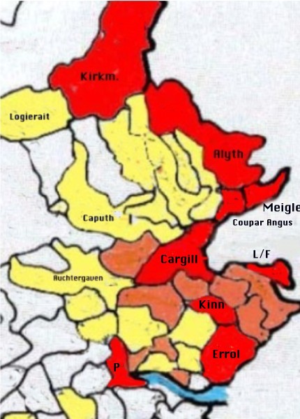
Above left is the map of East Perthshire. The red centers, from north to south, are Kirkmichael, Alyth, Meigle, Coupar Angus, Cargill, Lundie and Fowlis, Kinnaird, Errol, and all by itself, Perth. Notice the heavy concentration of coloured parishes from Perth all the way north to Kirkmichael. The furthest west that we lived were the parishes of Logierait and Auchtergaven.
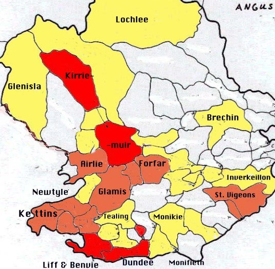
Above right is the map of Angus. There are only three red centers - Kirriemuir, Liff and Benvie, and Dundee. Most of the heavy concentration is on the border of Perthshire although a few Wightons did make it to the east side of Angus (and the North Sea) at Inverkeillon and St. Vigeons. Note how the strong concentration of brown next to Perthshire (Newtyle, Kettins) would slide into the Perthshire map next to Cargill and just underneath Coupar Angus and Meigle. There's an almost solid block of red and brown from Cargill in the west to Forfar on the east (24 miles) and from Kirkmichael and Kirriemuir in the north to Errol, Liff and Benvie, and Dundee (18 miles) in the south.
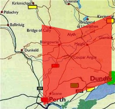
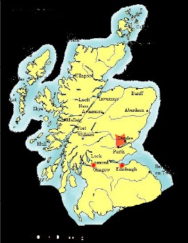
This concentration of Wightons within a 24x18 mile area of Perthshire and Angus can best be appreciated in the larger scale maps shown below. I've added our presence in Edinburgh and Glasgow in the map below right. Note that some Wightons did live outside of Angus and Perthshire during the period 1600-1850, but the numbers were quite small.
Sources
ScotlandsPeople Database (http://www.scotlandspeople.gov.uk/)