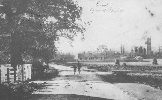

Errol, Carse of Gowrie (undated)
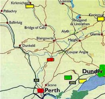
You may recall from the description of Kinnaird that the south-facing foothills of the Sidlaw Hills are called the Braes of the Carse. To their south is the Carse of Gowrie - a narrow strip of flatlands that lies between the Sidlaw Hills and the Tay River estuary. The village of Errol is situated in the Carse, next to the Firth of Tay, about 4 to 5 miles south of Kinnaird. It is midway between Dundee and Perth. In the map above right, Errol is the yellow rectangle and Kinnaird is the green.
The rich farmlands of the Carse are sheltered from the cold north winds by the hills. Generally, the soil had excellent quality and was reputed to be some of the most fertile in Scotland. Unlike nearby Kinnaird where livestock rearing was a significant component of the area's farms, Errol farmers concentrated on agricultural produce. The soil was too valuable to be used for pasture. The farms tended to be about 100 to 200 acres in size. Crops were mainly wheat (20%), grass (20%), and peas (20%). About 30% was in fallow, potatoes, and flax. The balance was in oats and barley. As a whole, the parish produced much more grain than it could use and so a great deal was sent each year to Perth and Dundee. Errol's proximity to the Firth of Tay meant that transport could be by the river. This was important since the low lying nature of the Carse meant that road transport was very difficult due to the deep soil's saturated conditions. At the time of the Statistical Accounts in 1795, a turnpike road was being built between Perth and Dundee and it was slated to go through the parish north of Errol. Another road was to be constructed from the turnpike to Errol.
Errol's proximity to the River Tay also meant that it was much easier for the population to import its necessities. Unlike the towns inland which had to use ground transport for necessities (e.g., coal for heating, lime for fertilizer), Errol farmers brought these in by boat during the summer and exported their grains in the winter in the same manner. Naturally, duties were applied to everything shipped in and out and those funds went to the local laird who owned the Errol lands and the port.
Most of Errol's 2,700 inhabitants (in 1795) were employed in agriculture. Weaving was the second most common occupation, but all of this was by hand; there was no manufacturing industry. Other trades included wrights (50), tailors (25), shoemakers (21), blacksmiths (14), masons (5), brickmakers (2), bricklayer (1), bakers (4), butchers (3), surgeons (2) and 1 writer.
Besides the poor condition of the roads, the only other major disadvantage noted in the Statistical Accounts was the lack of adequate potable water. There were no springs in the area and any streams flowing from the hills were so sluggish that they became poisoned by the clay in the soil. According to the author, this was something that they couldn't do anything about, and so inhabitants just had to live with it.
The pictures below are of the abandoned Errol RAF airfield from WWII. They give you an idea of what the area looked like.


Sources
Various web sites, including
The Gazetteer for Scotland (http://www.geo.ed.ac.uk/scotgaz/towns/townhistory1298.html)
Statistical Accounts of Scotland (http://stat-acc-scot.edina.ac.uk/)
Further reading: Wighton Families in Errol