The District of South Vancouver |
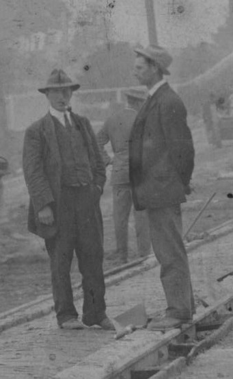
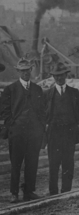
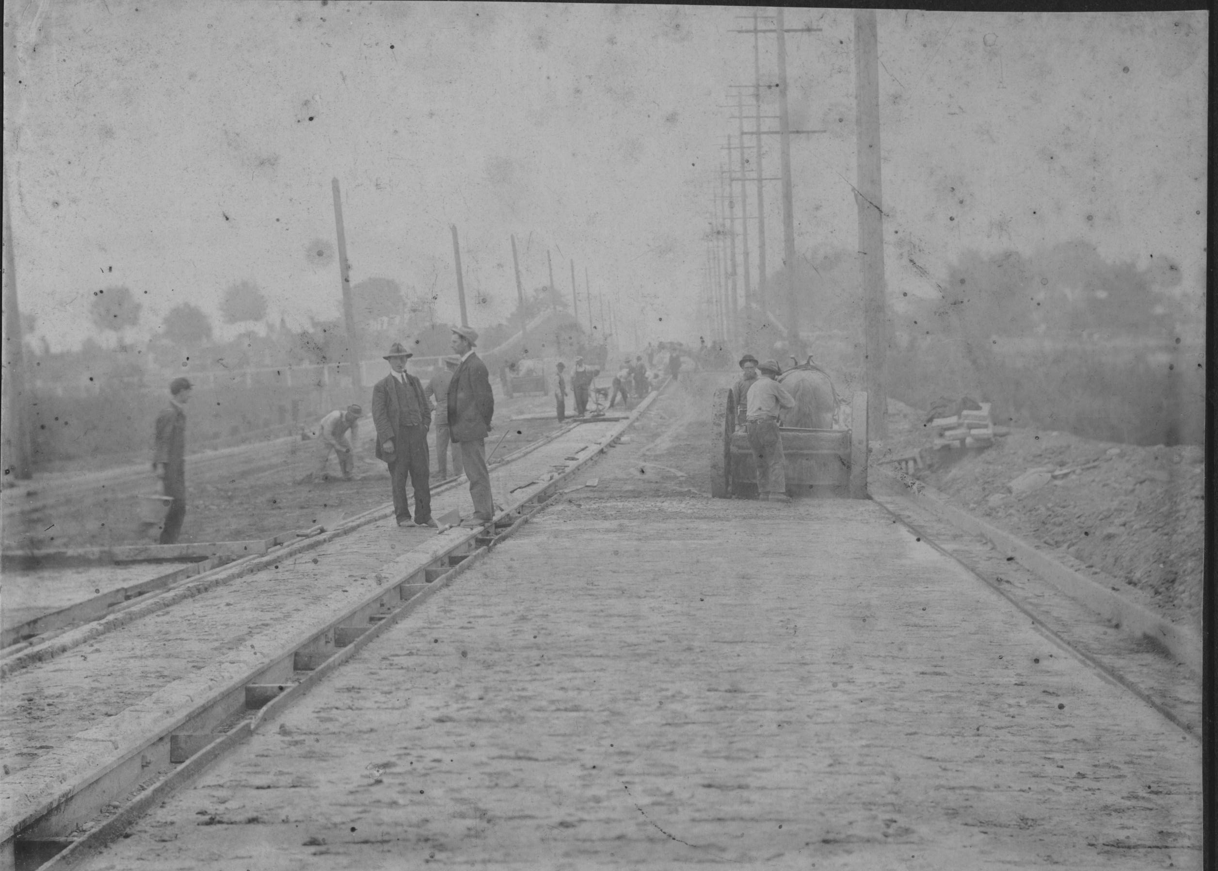
Two men supervising the construction work along 33rd Avenue in the District of South Vancouver, circa 1912-15 |
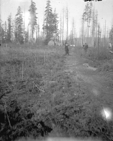
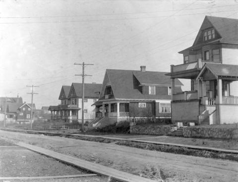
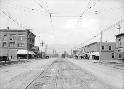
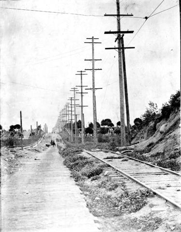
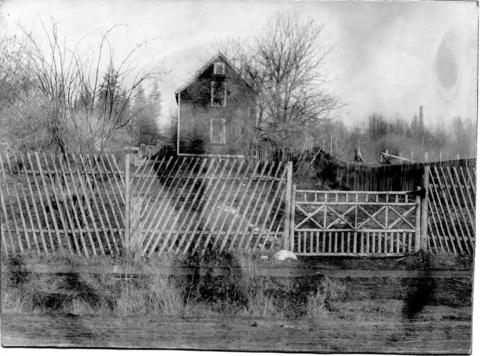
We have a letter dated July 10, 1915 from Mr. S. B. Bennett, the Municipal Engineer for the Corporation of the District of South Vancouver, that provides Harry Wighton with a work reference. This letter gives us a pretty clear picture of the work that Harry had been doing for the district. I'll be quoting that letter at length below. The family also has 6 framed photographs that show various stages of road construction. These same pictures, and many more, can be found in the Vancouver Archives as part of the collection of a Major Matthews. Major James Skitt Matthews was the City of Vancouver's first archivist and an early historian and chronicler of the city. He kept personal track of activities and events of the time. As his own collection grew, it was natural for him to start collecting general historical material from others in Vancouver. In the end, he amassed more than 500,000 photographs and hundreds of civic records and personal papers. We might presume quite safely that Major Matthews took these road construction pictures (or had them taken) and then gave a copy to Harry for his personal use. I will be incorporating other pictures that Matthews took in addition to our own because it's interesting to see not only Harry's contributions to early Vancouver, but also to learn more of what Vancouver was like at that time. First, let me explain about "The Corporation of the District of South Vancouver." The District/Municipality of South Vancouver was established on April 13, 1892, and at that time was comprised of all the land south of 16th Avenue and down to the Fraser River from Boundary Road west to the ocean. In 1908, a large portion of South Vancouver's land was hived off to become the Municipality of Point Grey. At the time of Harry's employment therefore, South Vancouver consisted of the area south of 16th Avenue down to the Fraser River, and from Boundary Road west to Cambie. The municipality consisted of 14.5 square miles with 4.5 miles of Fraser River waterfront. In 1911, when Harry started work, there were 120 miles of graded streets, 38 miles of macadamized (paved) streets, 110 miles of watermains, and 105 miles of sidewalks. All of this for a population of under 5,000 people of which 2,500 were children in schools. As to the topography of the district, the highest altitude was 601 feet, with the land sloping gently towards the river. At one point, this land had been heavily forested with huge trees. However, the area had been extensively logged and what remained was light second growth, or scrub brush. Large portions of the area would have been sparsely populated with the land to the north gradually taking shape as housing developments. In 1929, South Vancouver, Point Grey, and Vancouver were amalgamated into what we now know as Vancouver. Below are two pictures of the more remote areas of South Vancouver. The next two pictures show more developed areas - a residential unpaved street with wooden sidewalks and a picture of Main Street at 17th, looking north. Note the electric tram lines on the graded but unpaved road. |
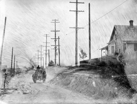
Now, on to the letter of reference. Mr. Bennett starts: I have pleasure in stating that Mr. Harry Wighton has been in the employ of this Municipality as Assistant Engineer for the past four years. Since the date of this letter was July 10, 1915, we can say with some certainty that he started work for the district in the first half of 1911. Based on his Salary Journal, I'd say his employment began at the beginning of March. We can also conclude that Harry ended his employment with the district in July, 1915. More on that later. Mr. Bennett continues: He has been in charge of the following construction work. Waterworks: The supervision of the laying of 5 miles of steel mains, house connections, hydrants, etc. Paving: The charge of paving contracts on Main Street, 34th Avenue, Kingsway, and Victoria Streets. The paving put down was Wood Block, Bitulithic, Concrete and Dolarway. In all eight miles. Storm Water sewers were also included. The Vancouver Archives has Major Matthews' collection of photographs of the road construction on 34th Avenue which, in time, became 33rd Avenue. This became a major Vancouver artery just like Kingsway, Victoria, and Main Street and Harry was in charge of building at least parts of them all. The two pictures below show 34th Avenue before the paving. |
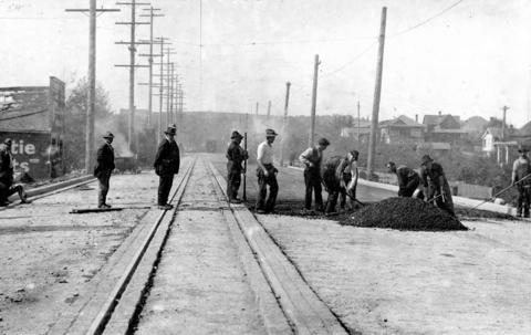
Now, below left is a picture you may recognize - it was at the top of this essay. Two men are supervising workers who are laying a concrete base on 34th Avenue. Something about the man on the left made me curious, so I magnified the picture so I could see him better. As I thought. He was smoking a pipe. Good looking man. Athletic. Probably played soccer in his youth. |
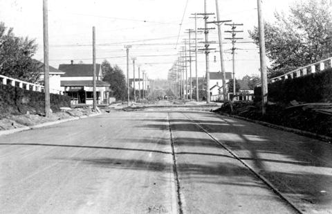
The next two pictures will be somewhat anticlimactic now that we know that smoking pipes were allowed on the work site. The first shows how a bitulithic finish was laid on top of the road surface; the second is 34th Avenue after it was finished. |
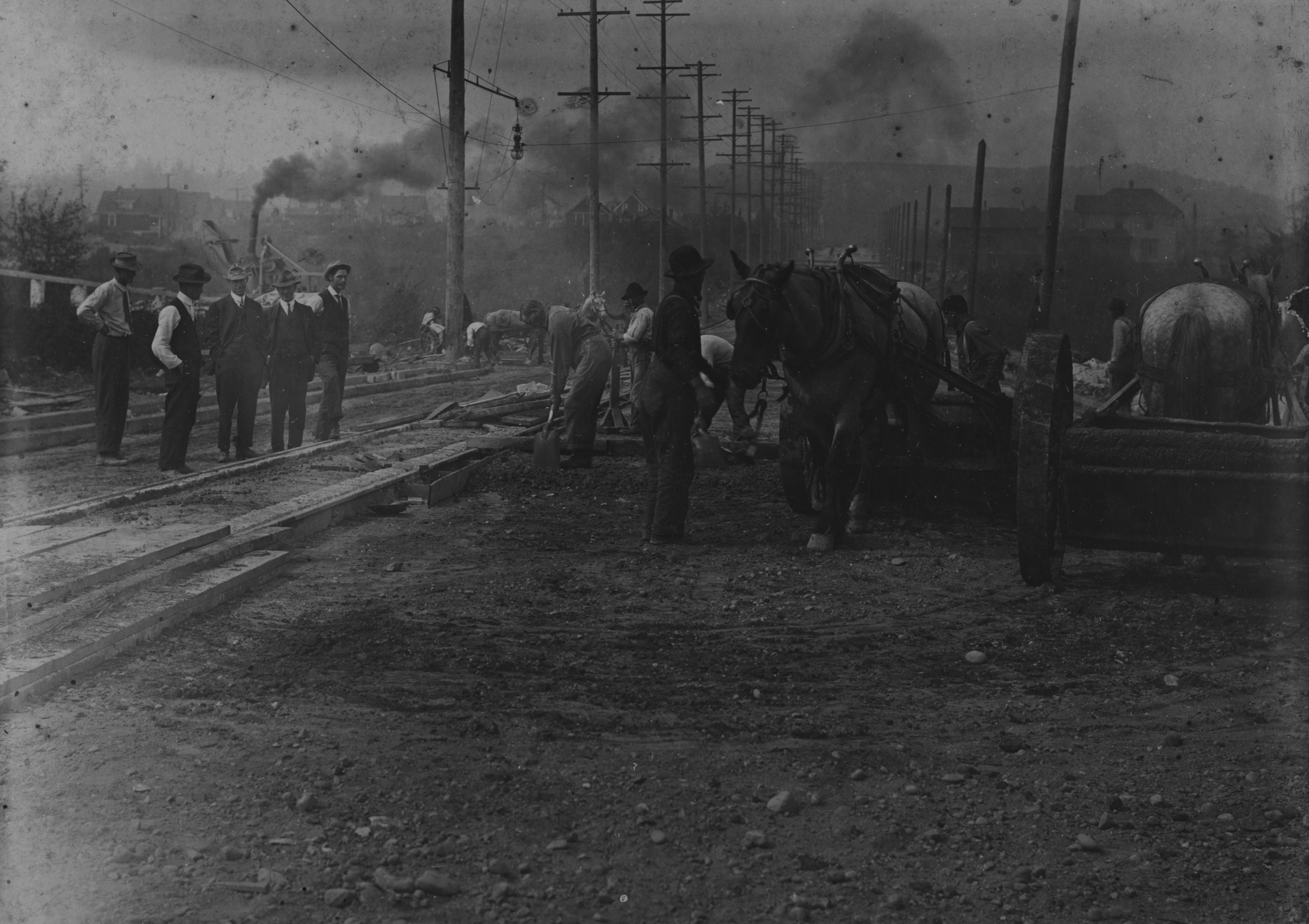
The next two pictures are interesting because they show how the use of horsepower was gradually being phased out in favour of other forms of power. Again, this work was on 34th avenue, and in the foreground of the picture on the left, you can barely see two horse-drawn carts being used to haul materials to the site and away. But, in the background, there's a steam shovel available for heavy digging. I've magnified the picture (below right), so that you can get a better idea of what it looked like. It's immediately behind the two supervisors in their suits and hats. If the supervisor on the right looks vaguely familiar, that's because he was the one smoking that tiny little pipe in a previous picture. What's in the background - now, that's a smoking pipe!! |
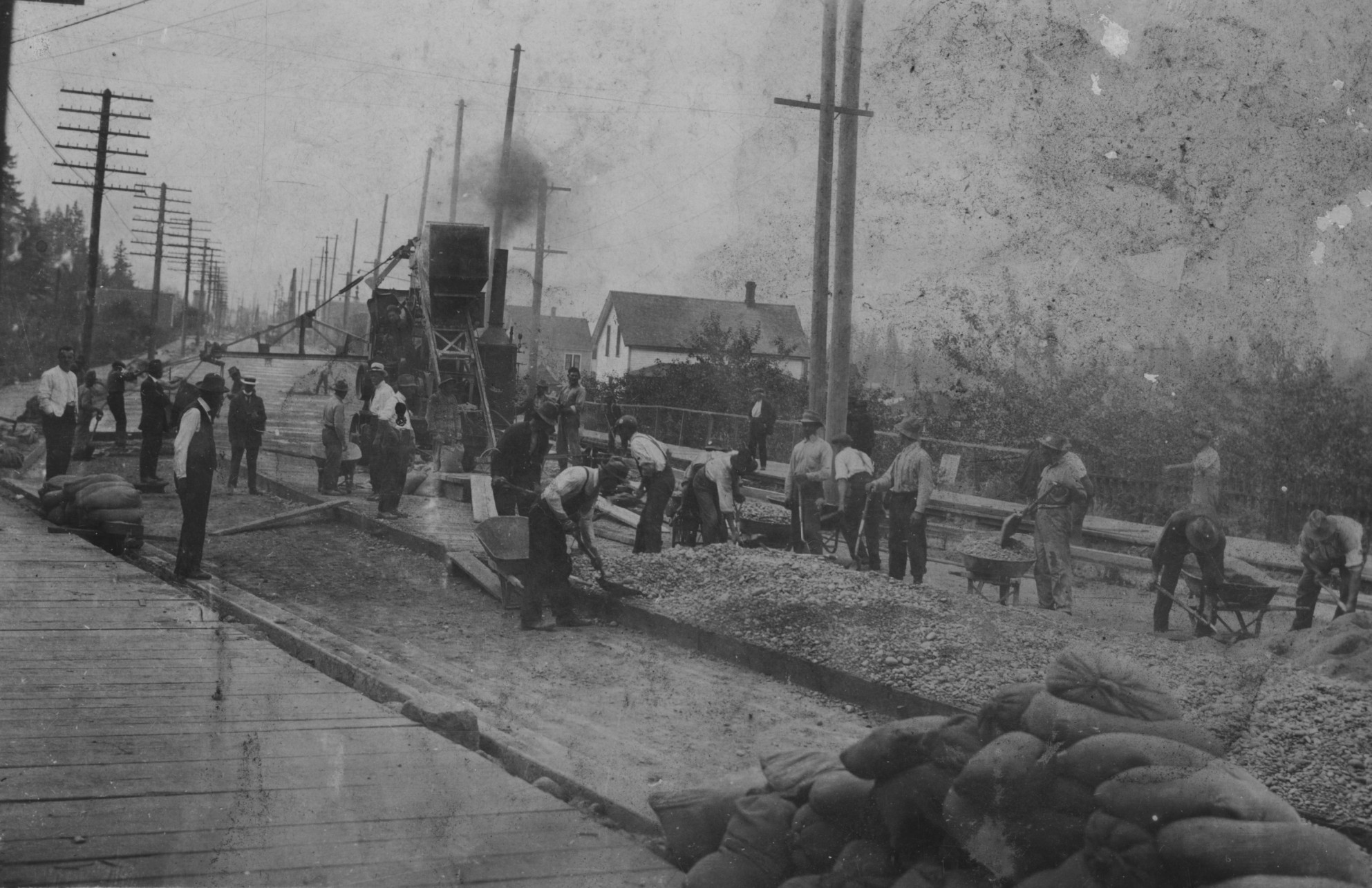
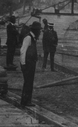
This next picture came from Harry's personal collection. On the left, a wide shot of paving being done on Kingsway in 1913, as per a handwritten note on the back. At first glance, I wondered why Harry had kept the picture as I didn't see any sign of him. You'll have difficulty picking him out too in this long range shot. I think he's on the left side of the big machine, standing in the unfinished trench. The picture below on the right is a magnified look at that part of the picture. I'm pretty sure that it's Harry standing facing the camera with one hand in his pockets in a Harry-like stance. The man closest to him in the trench, on the left, appears familiar and might be the other supervisor. Both men are wearing suit coats which is probably a pretty good indicator that they're not working up much of a sweat. The only thing giving me pause is the white-brimmed hat - it's not the same as he wore in other pictures that we have of him at the work site. Nobody else in the picture is the right height and wearing a suit coat, so why would he have kept the picture? You be the judge. |
Harry's recommendation letter ends with the following paragraph. For the past six months he has been assisting in designing the sewer scheme, including layout trunks and laterals, calculations and costs of proposed schema, manholes, lampholes, catch basins, flush tanks, detritus chambers and other details including the necessary field work. Mr. Wighton is conscientious, steady and reliable; and I have great pleasure in recommending him. |
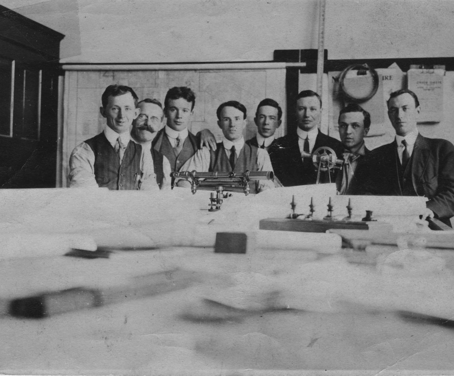
Harry on the far right with coworkers (?), possibly in 1915 after he announced that he was leaving. Note the surveying equipment on the table in front of them. |
Sources Harry Wighton photo collection and Salary Journal Various websites, including: Wikipedia: Major Matthews: http://en.wikipedia.org/wiki/J._S._Matthews The history of Metropolitan Vancouver: http://www.vancouverhistory.ca/archives_major_matthews.htm Municipality of South Vancouver: http://www.flickr.com/photos/heritagevancouver/7392021246/ Vancouver Archives: http://vancouver.ca/your-government/city-of-vancouver-archives.aspx |