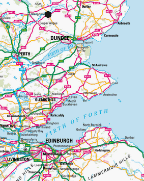
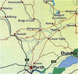
Let's get the village of Meigle located first. Above left is a map of south-east Scotland showing Edinburgh at the bottom and the cities of Perth and Dundee at the top. North-west of Dundee, the village of Meigle is marked with a black circle. The map above right is a closer look. Meigle is about 15 miles north-west of Dundee and about 2-3 miles south-east of Alyth. Coupar Angus to the south-west is about 5 miles away.
John Wighton and Ella Peterson started the family's genealogical research in the 1960's. The family knew very little about the early Wightons - essentially just that the family originated from the Meigle area and that they lived near the bridge over the River Dean. John and Ella hired the Scots Ancestry Research Society to trace the family lineage and the firm was successful in working backwards to John Wighton's marriage to Helen Mill in 1734. In the Society's report, the name POLENTO figured prominently in the birth records for the second and third generations. However, the Society gave no explanation of what this Polento was.
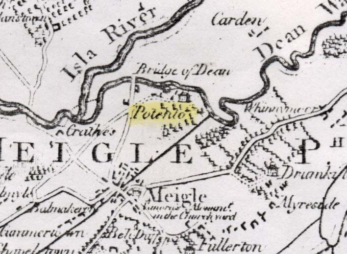
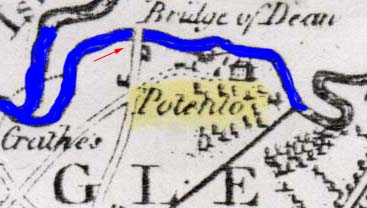
An active letter writing search by Ella Peterson eventually revealed the location of Polento and it was, indeed, near Meigle. Reproduced below left is a segment of the 1783 Map that Ella received from the National Library of Scotland. In addition to villages and rivers of 18th century Scotland, the map showed estates and estate houses - one of them being Polento. Polento was located right where family lore placed our original homestead - by the Bridge of Dean about 1 mile north of Meigle. The location of that bridge is a little difficult to see on the map. It's at the end of the white road coming out of Meigle and just below the "B" of the word "Bridge." If you look closely, you can see a small house symbol representing the Polento Estate house. Notice as well that the word Polento is on the map on the farm land that lies between the estate house and the village of Meigle. Thus suggests that the Polento land extended an unknown distance towards Meigle.
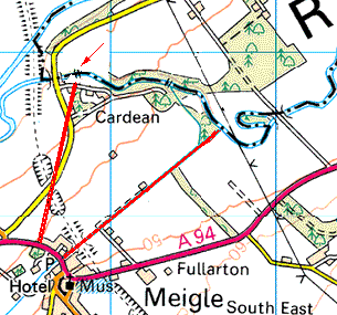
Below right is a contemporary map of the same location. I have used a red arrow to point to the location of the bridge. Also, I've used a straight red line to mark the approximate position of the 18th century road from Meigle to the bridge. I've used another red boundary line to represent a black boundary line on the old map. You can see that the Polento estate in the 1783 map has become the Cardean Estate in the contemporary map.
Further information on the Polento Estate or the Cardean Estate proved impossible to find on the web. However, noting how indecipherable the estate name was on the 1783 map (even under electronic magnification), I tried searching with different combination of similar letters and the word POTENTO unlocked some mysteries. It turns out that the estate house was named POTENTO and not Polento after all. If you're interested, you can read further on the History of Potento Estate here.
Below left is a picture of the Bridge over the River Dean as it was in 2000 when the author visited Meigle. Below right is a blown-up image of the 1783 map with the red arrow showing the camera angle. The bridge was never a Roman Bridge, although there was a Roman camp on the north side of the Dean River and it is from this camp that the name Cardean is drawn. The bridge itself was built around 1570. According to local legend, a noble lady was travelling through the area one late, stormy night. Her carriage came to the ford over the Dean River and over the coachman's objections, she ordered him to try to make the passage. The river was too much and the driver was drowned. Local justice was served by requiring the noble lady to have a bridge built.
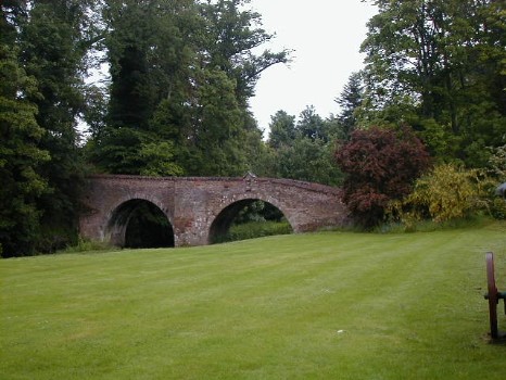
In the 1800s, the property where the picture was taken held the Cardean Mill. In the 1990s, the building was a derelict. Douglas Ware restored the building to a bed and breakfast and it was here that the author and his fiancee stayed before their wedding in the Meigle Church in June 2000.